

PENGGUNAAN DATA PENGINDERAAN JAUH DAN SIG UNTUK PEMANTAUAN KEKRITISAN DI DAS LUK ULO HULU JAWA TENGAH (Use of Remote Sensing Data and GIS (Geographic Informatiion System) for Monitoring Cryticalness in DAS Luk Ulo Stream, Central Java Province)
Puguh Dwi Raharjo(1*)
(1) Balai Informasi dan Konservasi Kebumian Karangsambung - LIPI
(*) Corresponding Author
Abstract
ABSTRAK
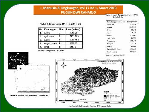
DAS Lukulo Hulu adalah DAS yang berada di Jawa Tengah dengan koordinat 340.000 - 365.000 mT dan 916.0000 - 917.5000 mU. Aktifitas masyarakat dimungkinkan sangat mempengaruhi kondisi DAS, yaitu dengan ekploitasi sumberdaya alam (batu, pasir). Pada DAS Lukulo Hulu mempunyai 7 (tujuh) Sub DAS yaitu, DAS Lukulo, DAS Lokidang, DAS Maetan, DAS Gebang, DAS Loning, DAS Mondo, dan DAS Cacaban. Pehitungan lndeks Erosivitas Tertimbang menggunakan SIG (Sistem lnformasi Geografis) memperlihatkan bahwa DAS Lokidang merupakan DAS kritis yang mempunyai prioritas pertama, nilai dari total lndeks Erosivitas Tertimbangnya sebesar 1082,62 dengan luas DAS sebesar 3602,705 hektar. Darr sudut nandang penutup lahan (vegetasi) dengan metode penginderaan jar.rh menggunakan transformasi NDVI (Normalized Difference Vegetation Index) DAS Gebang, DAS Cacaban, dan DAS Lukulo merupakan DAS yang sangat mudah rusak (erosi) hal tersebut karena pentrukaan lahannya tidak terdapat vegetasi sehingga mudah tererosi.
ABSTRACT
Lukulo Upstream Watershed is watershed which located in Central Java with coordinate 340.000 - 365.000 mT and 916.0000 - 917.5000 mU. Human activities which still immeasurable influence the watershed condition, its exploitation of natural resouces (rocks, sand). In Lukulo Upstream Watershed there are seven sub watershed they are Lukulo sub watershed, Lokidang sub watershed, Maetan watershed, Gebang watershed, Loning watershed, Mondo watershed, and Cacaban watershed. Calculation using GIS (Geographic Information System) for deliberated erosivity index formula found that Lokidang watershed is first priority of watershed criticaly, value the deliberated erosivity index equal to 1082,62 broadly 3602,705 hectare. While from viewpoint land cover (vegetation) with remote sensing method transformation using NDVI (Normalized Difference Vegetation Index) Gebang watershed, Cacaban watershed, and Lukulo watershed is watershed which is very easy of damage (erosion) because the land surfaces which do not closed with vegetatation so erosion is easy.
Full Text:
ARTIKEL LENGKAP (PDF) (Bahasa Indonesia)Article Metrics
Refbacks
- There are currently no refbacks.
Copyright (c) 2017 Jurnal Manusia dan Lingkungan
JML Indexed by: